| Comment: |
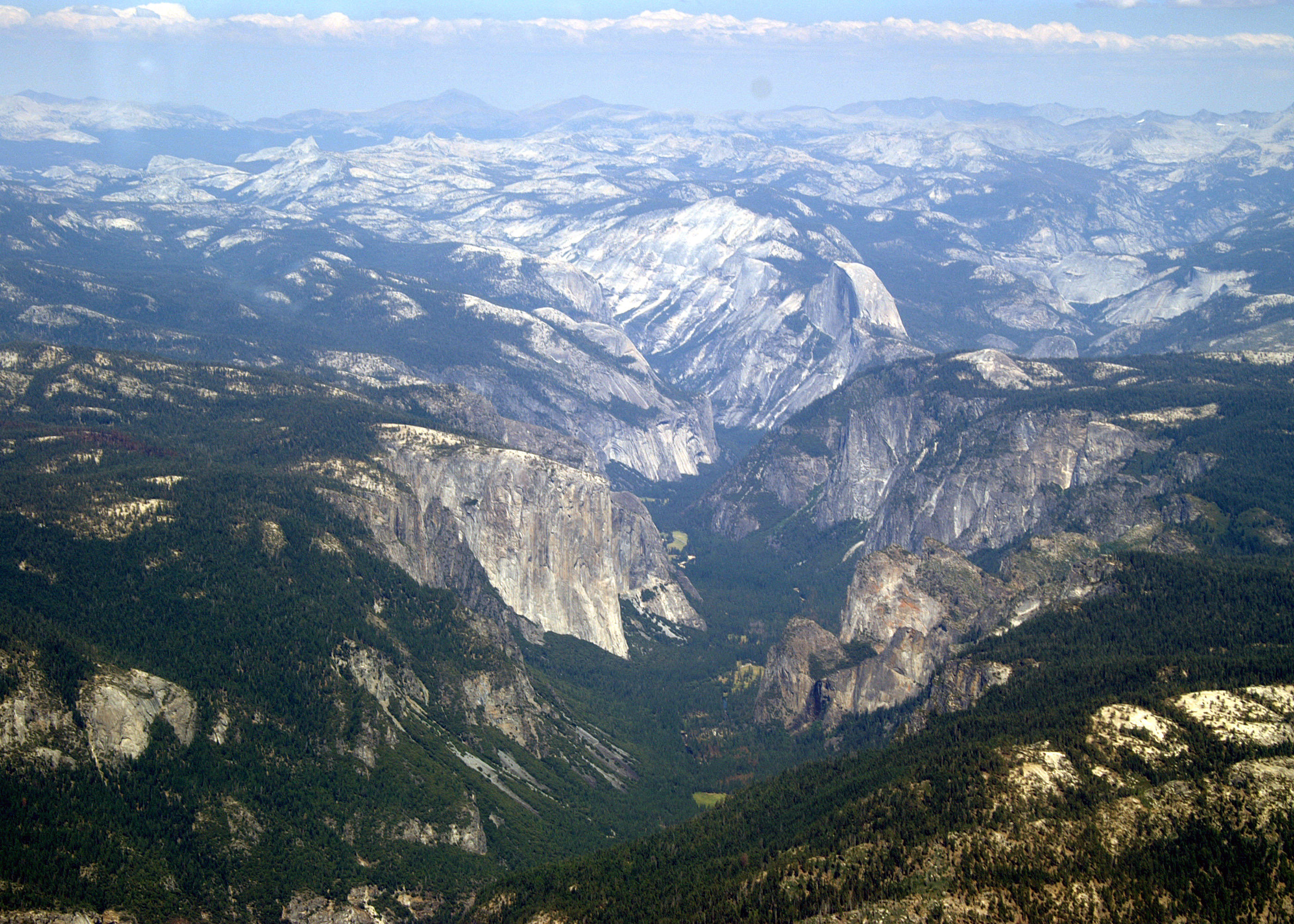
This this is another picture of the central Yosemite Valley area taken over the road up to the valley. It provides a bird's eye view of the scene observed by visitors driving in. On the left side of the valley is El Capitan. On the right side, from is Half Dome and Glacier Point with Sentinel Dome on its top. Not visible behind the big rocks on the right is the location of Bridal Veil Falls. Also not visible, but behind the large rocks extending into the valley on the right behind El Capitan is the location of Yosemite Falls. Since the region was experiencing a drought and this flight was in late August, these two falls were dry. Later in this album is a picture showing the dry Yosemite Falls, but there was not a good opportunity to photograph the dry Bridal Veil Falls. |
| Image Date: |
Aug 04, 2007 - 03:08 PM |
| Original: |
PICT1646ac.jpg
, 2.19 MB, 2800 x 2000
|
| Gallery: |
Yosemite Flight Album |
| Camera: |
MAXXUM 5D |
| Settings: |
Focal len: 219 mm, Exposure: 1/200s, Aperature: F13.0 |
|