| Comment: |
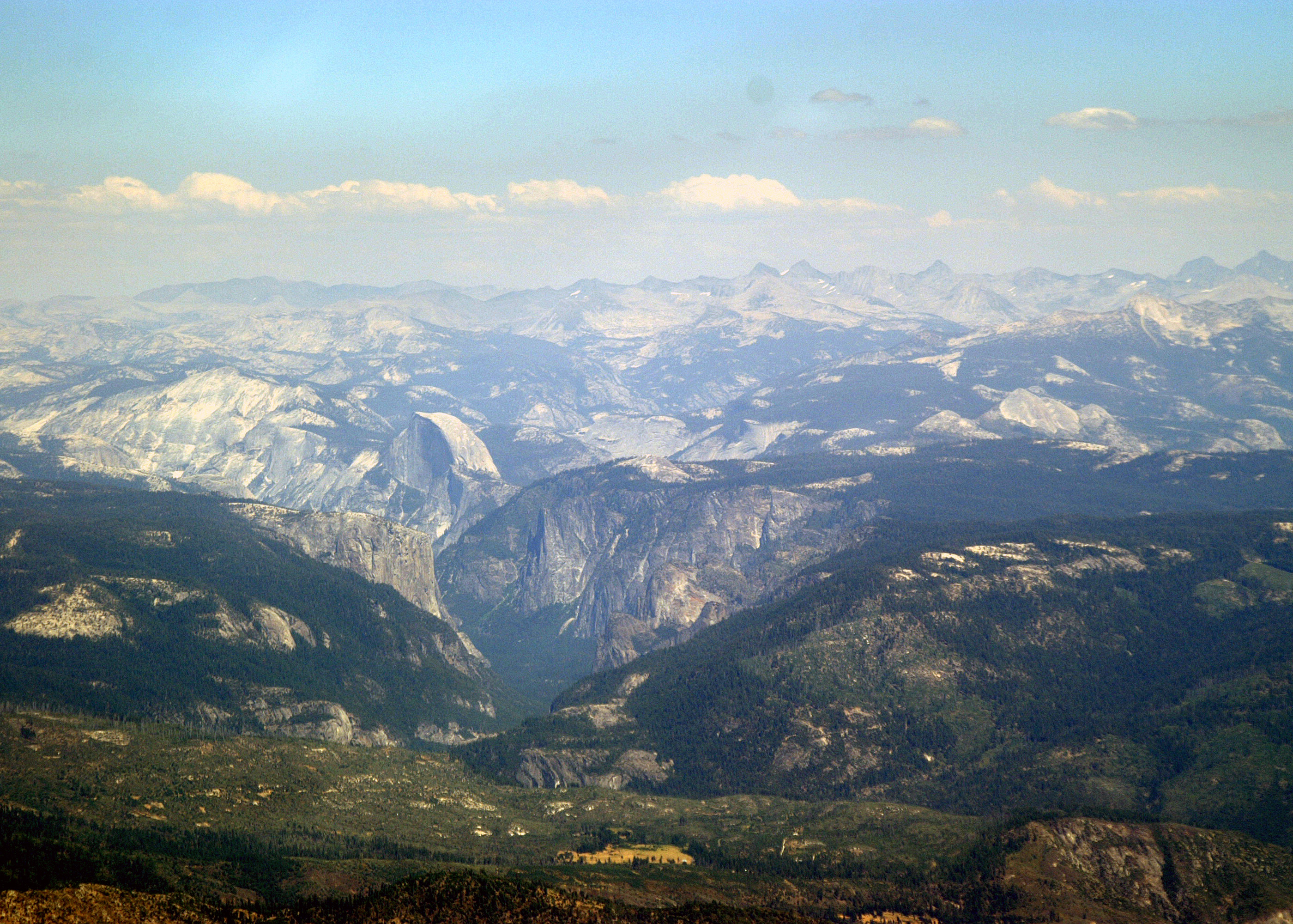
Returning to the target of this flight, this picture is of the Central Yosemite Valley area showing El Capitan, Half Dome, Glacier Point and Sentinel Dome. The southern part of the park highlands are visible beyond with the high Sierra Mountains in the background. This is the classic view of Half Dome, but it is the side of El Capitan. The normal photographed view of El Capitan with its 3000 ft cliff is at right angle to this view, facing the valley Julie is now near her service ceiling at 11,500 ft, the appropriate Visual Flight Rules (VFR) altitude for easterly flight with a 2,000 ft clearance of the highest terrain in our planned flight path. The flight is getting bumpy and I am having difficulty framing pictures. I am glad I am using a single lens reflex (SLR) camera which instantly takes the picture when the shutter release is pressed. |
| Image Date: |
Aug 04, 2007 - 02:39 PM |
| Original: |
PICT1590ac.jpg
, 2.1 MB, 2800 x 2000
|
| Gallery: |
Yosemite Flight Album |
| Camera: |
MAXXUM 5D |
| Settings: |
Focal len: 413 mm, Exposure: 1/320s, Aperature: F11.0 |
|