| Comment: |
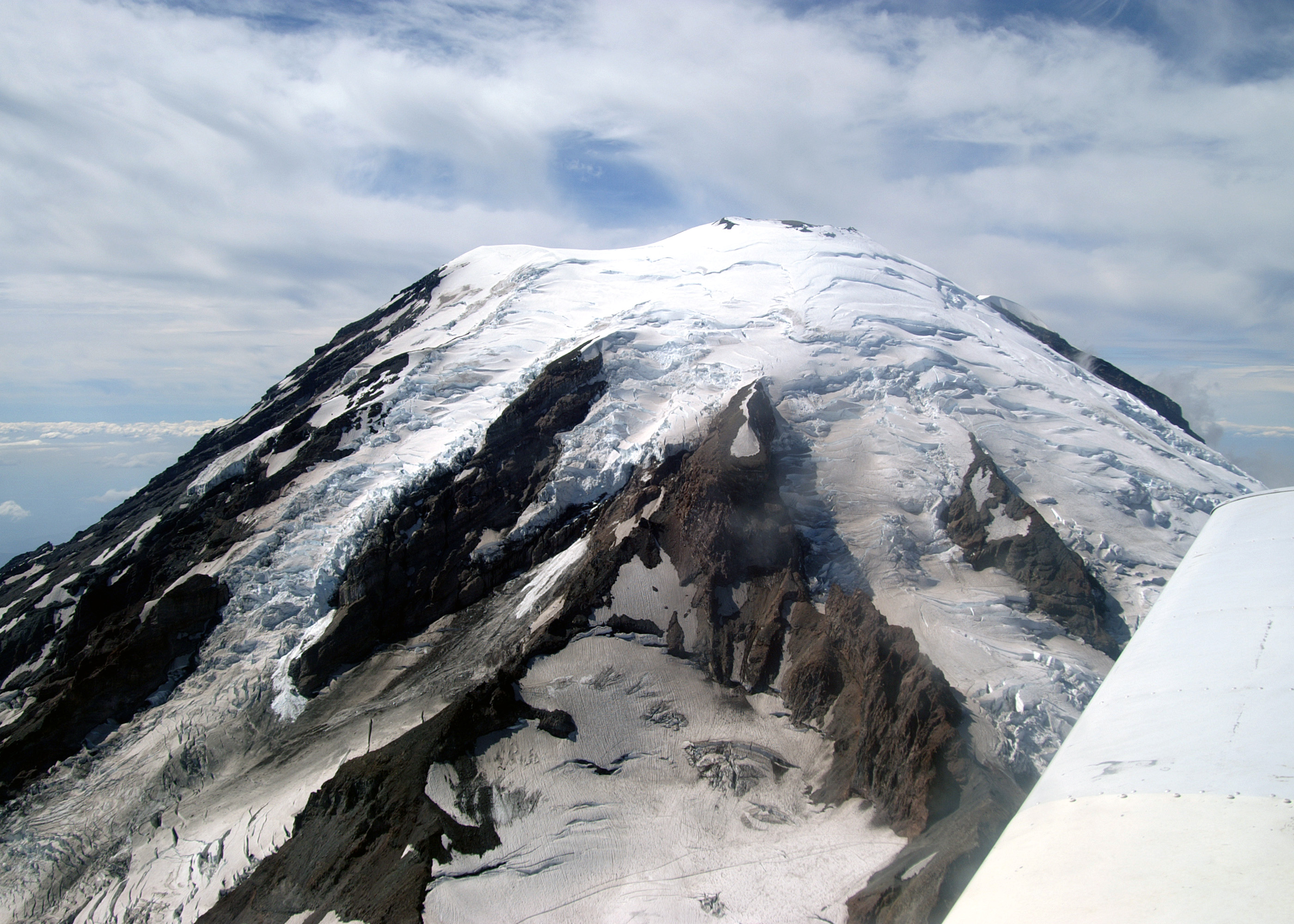
The southeast side of Rainier. Visible in this picture (from left to right) are the Nisqually, Cowlitz, Ingraham and Emmons Glaciers. Also visible, particularly when the full sized image is examined, is the rim of easternmost of the two summit craters. The Columbia Crest marks the high point on the left side of the crater. When this picture was taken Julie was over 13,000 ft, about 2 miles from the summit. |
| Image Date: |
Aug 11, 2007 - 03:20 PM |
| Original: |
PICT2050ac.jpg
, 1.51 MB, 2800 x 2000
|
| Gallery: |
StHelens-Rainier_Flyby_Album |
| Camera: |
MAXXUM 5D |
| Settings: |
Focal len: 117 mm, Exposure: 1/500s, Aperature: F10.0 |
|