| Comment: |
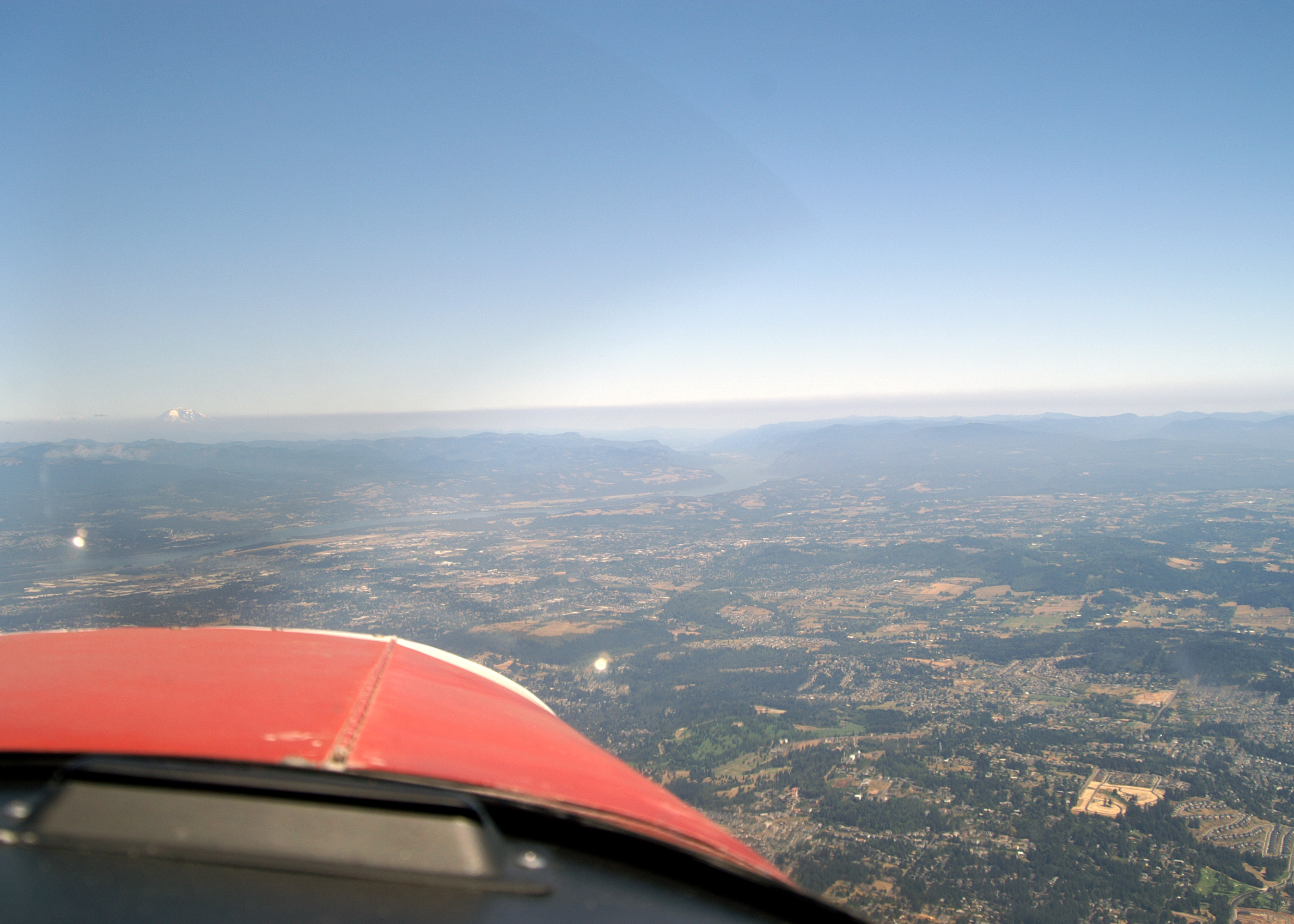
The mouth of the Columbia River Gorge as seen from over Portland (about 20 miles away). The gorge is a river canyon cutting a near sea-level route through the Cascade Mountains. It is about 80 miles long and up to 4,000 feet deep with the north canyon walls in Washington State and the south canyon walls in Oregon State. The layer of smoke over the mountains on either side of the gorge is from the fire to the east of Mount Jefferson visible in two pictures near the end of the San Carlos to Twin Oaks Flight Album Mount Adams (12,276') can be seen on the left above the smoke layer. |
| Image Date: |
Aug 11, 2007 - 01:49 PM |
| Original: |
PICT1884ac.jpg
, 1.21 MB, 2800 x 2000
|
| Gallery: |
StHelens-Rainier_Flyby_Album |
| Camera: |
MAXXUM 5D |
| Settings: |
Focal len: 117 mm, Exposure: 1/250s, Aperature: F10.0 |
|