| Comment: |
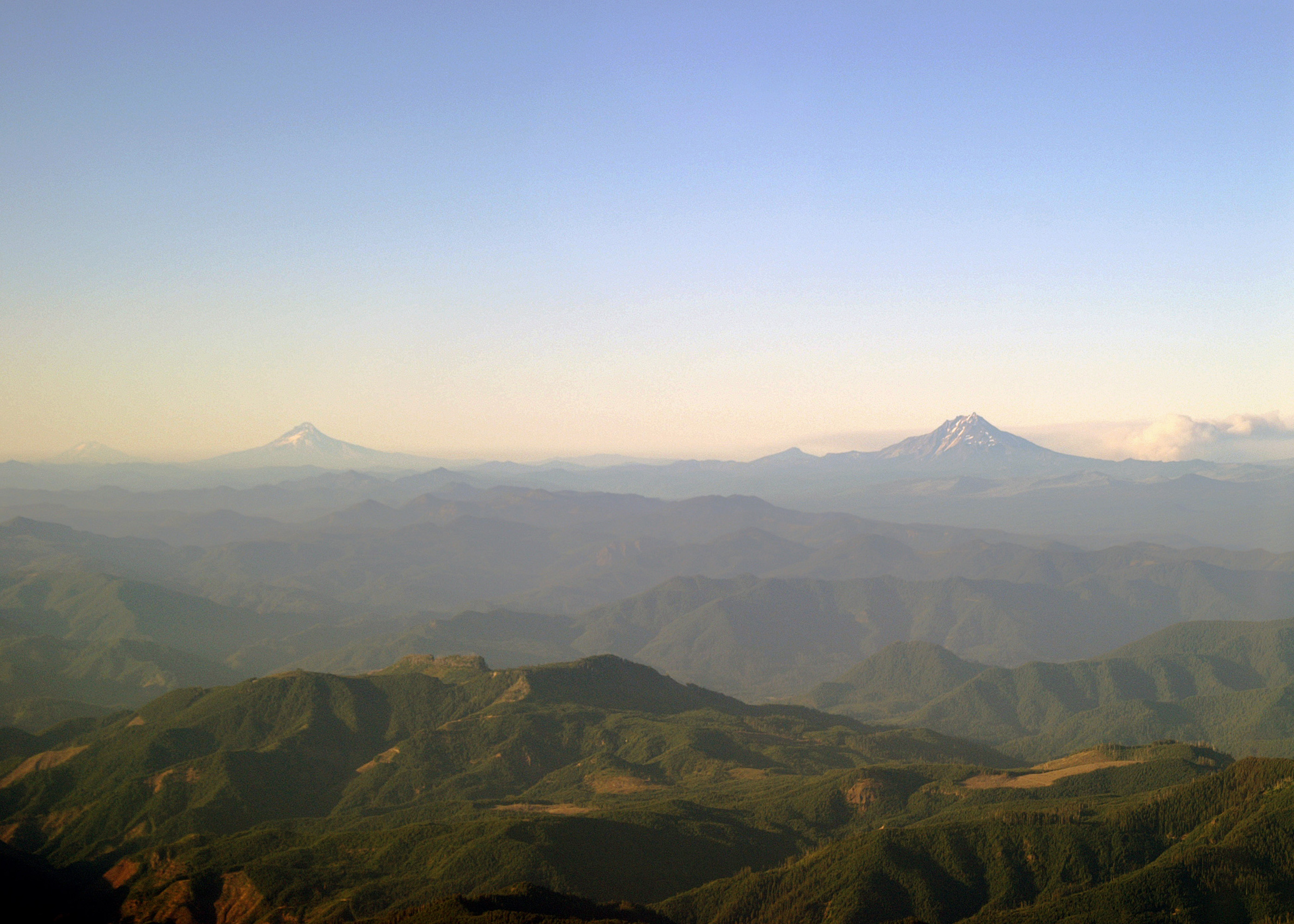
The northern Oregon Volcanoes. On the right just over 40 miles away is Mount Jefferson (10,497'). On the left in the distance, almost 90 miles away, is Mount Hood (11,249'). The small peak between the two is Olallie Butte (7,215'). Note the smoke from a large forest fire to the right (east) of Mount Jefferson. Way in the distance (~150 miles away), to the left of Mount Hood, upon close examination of the full sized picture, Mount Adams (12,276') in Washington State can be seen. |
| Image Date: |
Aug 10, 2007 - 07:17 PM |
| Original: |
PICT1823ac.jpg
, 1.32 MB, 2800 x 2000
|
| Gallery: |
San_Carlos_to_Twin_Oaks_Flight_Album |
| Camera: |
MAXXUM 5D |
| Settings: |
Focal len: 292 mm, Exposure: 1/200s, Aperature: F10.0 |
|