| Comment: |
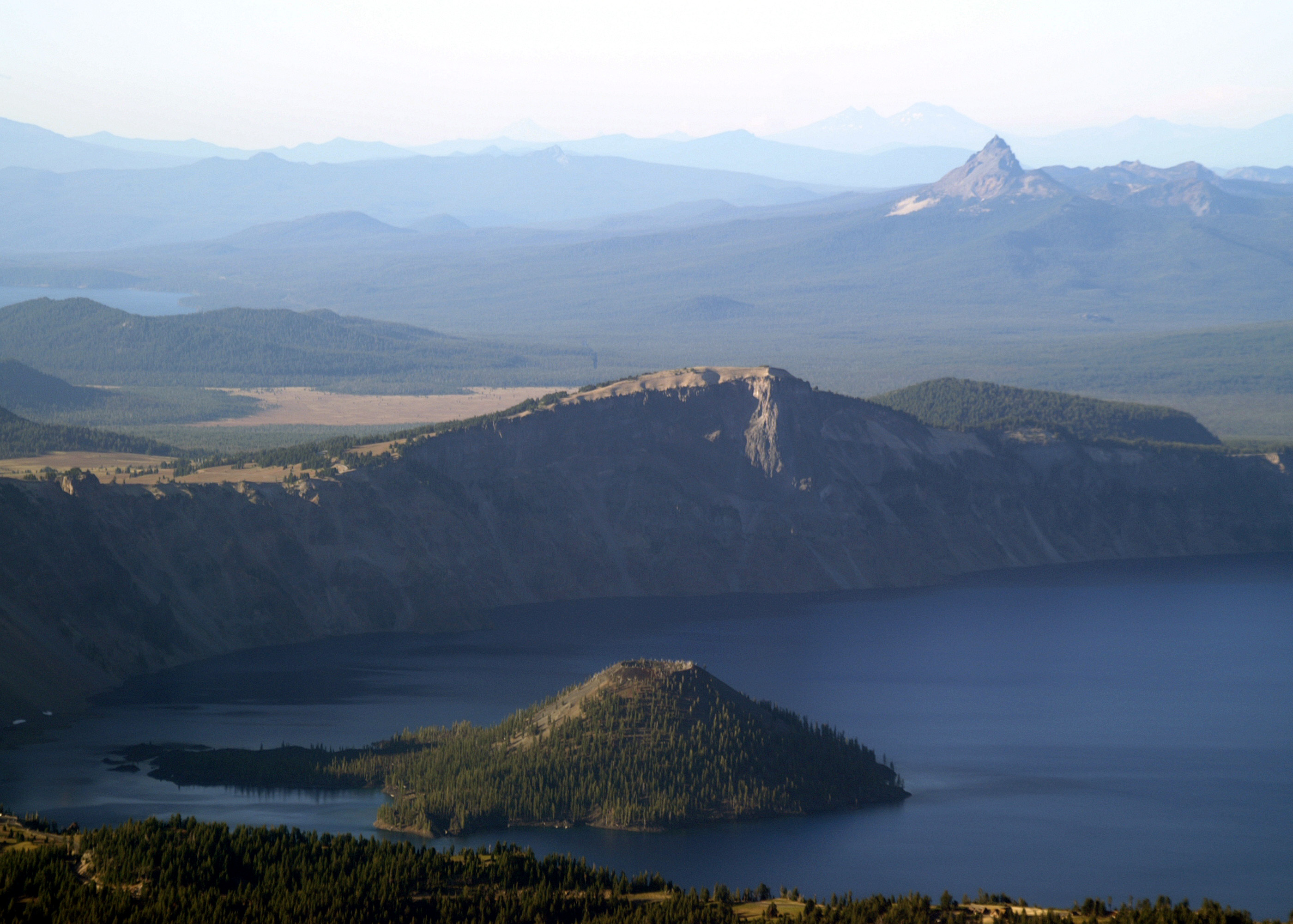
A view of the western side of Crater Lake featuring Wizard Island (6940'). Being protected from winds inside the crater its cinder cone is very symmetrical with a well defined crater at the summit. Liao Rock (8045'), part of the caldera rim is directly above Wizard Island is the cross sectional remnant of a large lava flow that overfilled a valley on the side of Mount Mazama, the name for the ancestral volcano from which Crater Lake formed. The high cliff is the filled-in valley and the "wings" on either side of the cliff are the portion of the flow that extended beyond the valley. The caldera rim ranges in elevation from 7,000 to 8,000 ft. The elevation of the lake surface is 6,176 ft. Maximum depth is 1932 ft. The average depth is 1500. To the right of Llao Rock and beyond the rim is Grouse Hill (7,412'). The barren brown area to the left is the Pumice Desert, an ~5.5 square mile area covered with material created when Mount Mazama exploded. This ash, pumice and other material filled a valley, reaching over 100 ft deep in places. This area is largely devoid of plants due to excessive porosity and poor soil composed primarily of regolith. Mount Thielsen (9,184') is the sharp peak 11 miles beyond the lake. Diamond Peak (8,744') is 38 miles in the distance on the left. In the far distance, 80-85 miles away, just above Mount Thielsen and barely discernable are North (10,085') & Middle (10,047) Sister (almost appearing to be one peak), South Sister (10,358), Broken Top (9,175') is further to the right and Mount Bachelor (9,068') is at the right edge. |
| Image Date: |
Aug 10, 2007 - 06:40 PM |
| Original: |
PICT1781ac.jpg
, 1.18 MB, 2800 x 2000
|
| Gallery: |
San_Carlos_to_Twin_Oaks_Flight_Album |
| Camera: |
MAXXUM 5D |
| Settings: |
Focal len: 413 mm, Exposure: 1/250s, Aperature: F8.0 |
|