| Comment: |
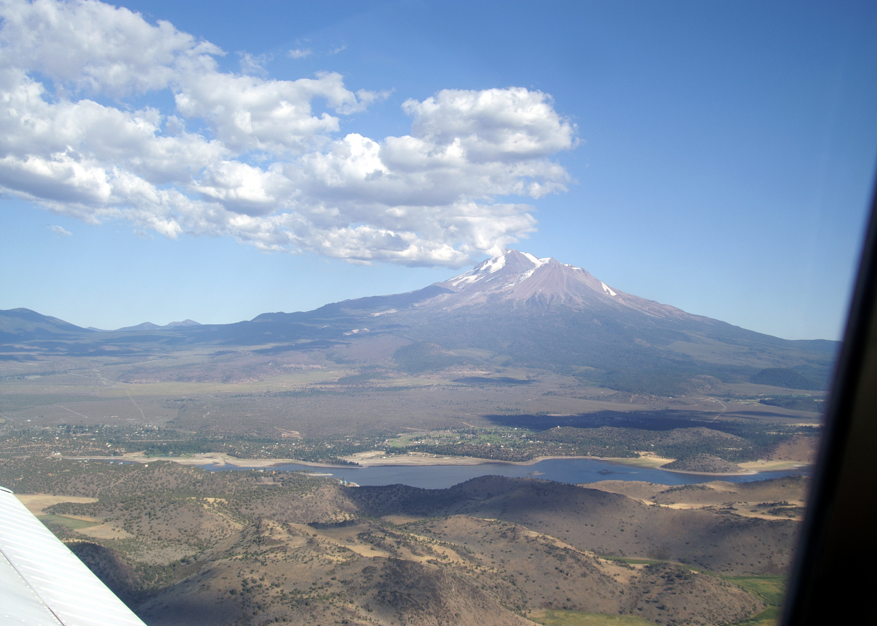
Departing the Mount Shasta Area. The rough, lumpy look of the Shasta Valley below had been a geological mystery. It is a flat, arid plain punctuated by hundreds of hills, ridges, and small closed depressions (not connected by surface streams). Only after Mount St Helens blew out and the resulting avalanche debris field was studied did the explanation become clear. Geologists discovered evidence indicating that about 300,000 years ago a gigantic sector of an ancestral Mount Shasta (probably just as high as the current mountain), collapsed catastrophically and avalanched into Shasta Valley. The resulting landslide was 20 times larger than the Mount St. Helens avalanche. The man made Lake Shasta is in the foreground. |
| Image Date: |
Aug 10, 2007 - 05:52 PM |
| Original: |
PICT1759ac.jpg
, 1.24 MB, 2800 x 2000
|
| Gallery: |
San_Carlos_to_Twin_Oaks_Flight_Album |
| Camera: |
MAXXUM 5D |
| Settings: |
Focal len: 117 mm, Exposure: 1/250s, Aperature: F10.0 |
|